AeroVisibility delivers AI-powered drone and robotics solutions for ports, enabling real-time monitoring, infrastructure intelligence, and environmental compliance. The integrated DaaS, EMD, and AI platform help ports reduce costs, improve safety, enhance ESG performance, and operate as future-ready smart maritime ecosystems
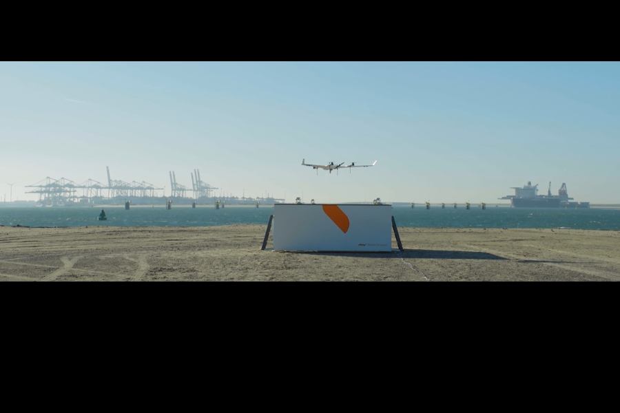
The BizIQ Emission Monitoring Drone delivers real-time, high-accuracy emissions measurement for vessels, ports, and industrial maritime zones. Using advanced sensors and AI analytics, it captures SOx, NOx, CO₂, and particulate levels directly from ship plumes—enabling fast compliance checks, transparent reporting, and independent verification.
Precise measurement of SOx, NOx, CO₂, PM, and other pollutants captured directly from ship exhaust plumes.
Aerial inspection eliminates manual sampling, boarding delays, and operational disruptions.
Instant alerts and analytics to identify non-compliant vessels and assess emission intensity.
Generate independent, audit-grade reports for EU ETS, CII verification, and port environmental checks.
Monitor emissions across terminals, anchorages, coastal corridors, and industrial maritime zones.
Drone data feeds directly into ESG scores, benchmarking, and compliance dashboards for complete visibility.
A fully managed aerial intelligence platform designed for ports, governments, and respective authorities to operate efficiently, digitalise the port and make port at ease with inspection, surveillance and more services
Review port directives, define monitoring scope, and analyze historical emission data.
Align with port officials and Vessel Traffic Services to finalize flight zones and compliance requirements.
Mobilize the drone team, deploy the boat, and perform equipment and safety checks on-site.
Launch the drone and activate autonomous flight and vessel tracking as per pre-approved routes.
Continuously collect emission data while monitoring flight stability and sensor accuracy.
Process collected data using advanced analytics and prepare structured emission reports.
Review findings, validate results, and ensure accuracy and regulatory alignment.
Share finalized reports with port authorities and regulatory bodies for compliance and records.
Use insights to improve environmental policies and strengthen ESG performance and reporting.
Drone-based inspection of cranes, jetties, tug boats, terminals, storage tanks, and other critical infrastructure for operational safety and maintenance planning.
High-precision LiDAR scanning, visual mapping, and digital twin creation for accurate site visualization, modeling, and infrastructure management.
Hydrographic and underwater terrain surveys for dredging planning, sediment analysis, coastal studies, and port expansion or reclamation projects.
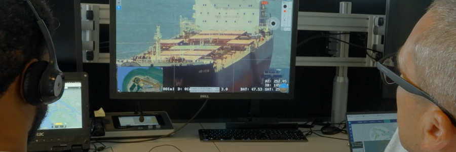
Real-time surveillance and inspection services for ports, terminals, storage facilities, and restricted operational zones using advanced drone systems.
Drone-enabled volumetric calculations, stockpile analysis, and construction progress tracking for efficient project monitoring and reporting.
Monitoring of coastal zones, mangroves, shoreline conditions, and water quality parameters to support environmental sustainability and compliance.
AI-driven asset health monitoring, predictive maintenance insights, and operational risk assessment to improve safety and reduce downtime.
Support for regulatory documentation, sustainability tracking, ESG intelligence reporting, and environmental compliance management.
Scheduled autonomous drone missions, UTM-enabled operations, emergency response support, oil spill monitoring, safety incident alerts, and rapid field assessment.
Ports today are no longer just cargo gateways—they are complex ecosystems of infrastructure, safety, environment, and governance. As ports expand and modernize, authorities must meet stricter regulatory, compliance, and ESG expectations. Accurate, continuous, and transparent monitoring is critical to ensure safety, sustainability, and informed decision-making across port operations and development.
Traditional inspection and monitoring methods rely on manual surveys, periodic checks, or asset-specific equipment that is slow, costly, and limited in coverage. These approaches struggle to deliver real-time visibility, scale across large port environments, or adapt to rapidly changing operational and environmental conditions—making compliance, planning, and risk management increasingly difficult.
AeroVisibility's Drone-as-a-Service (DaaS) delivers continuous aerial intelligence for ports and authorities. We manage drones, sensors, pilots, AI analytics, and compliance workflows to provide real-time insights, digital twins, automated reporting, and ESG-ready outputs. This enables safer operations, faster decisions, lower costs, and future-ready port management—without the burden of owning or operating drone infrastructure.
High-precision sensors measure SOx, NOx, CO₂, and particulates directly from vessel plumes.
Aerial monitoring eliminates boarding delays, manual sampling, and inspection downtime.
Generate independent, regulator-grade emission reports to support EU ETS, CII, and port audits.
Instant insights help ports, authorities, and operators identify violators, reduce penalties, and improve environmental performance.
Real-time port security monitoring. Risk reduction & operational control across all zones.
Al-driven inspection of cranes, quay walls, tanks. Predictive maintenance, lifecycle savings.
> 50% faster surveys. Real-time volumetrics for dredging, reclamation & expansion projects.
All data in Visibility Al. Multi-department usage, continuous intelligence, digital twin.
See our drone technology in action with a live demonstration.